
Alexander Swanston Boeken

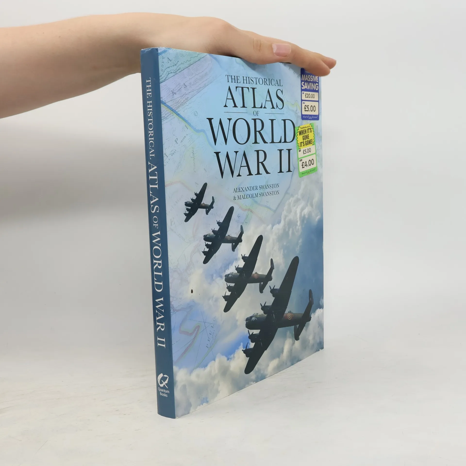
Atlas des Zweiten Weltkriegs
- 397bladzijden
- 14 uur lezen
Bücher über den 2. Weltkrieg gibt es viele, dieser Band aber ist besonders – durch seine rund 170 Karten von allen wichtigsten Kriegsschauplätzen rund um den Globus: Aufmarschpläne, Kampfverläufe, Abschnittskarten mit Zuordnung der beteiligten Truppenteile bis hin zu Stadtplänen, etwa vom Endkampf um Berlin. Nicht minder eindrucksvoll sind die historischen Fotos vom Kampfgeschehen selbst, die Informationen über die Hintergründe des Krieges, den Verlauf an West- und Ostfront, die Kämpfe im Atlantik und Pazifik. Der Luftkrieg, der Seekrieg und die Nebenschauplätze wurden ebenfalls nicht vergessen, so kann der militärische Verlauf des 2. Weltkrieges in seinen großen, kriegsentscheidenden Linien und Etappen nachvollzogen werden. Ein umfangreicher Anhang mit Statistiken rundet die Darstellung dieser größten Katastrophe des 20. Jahrhunderts ab.
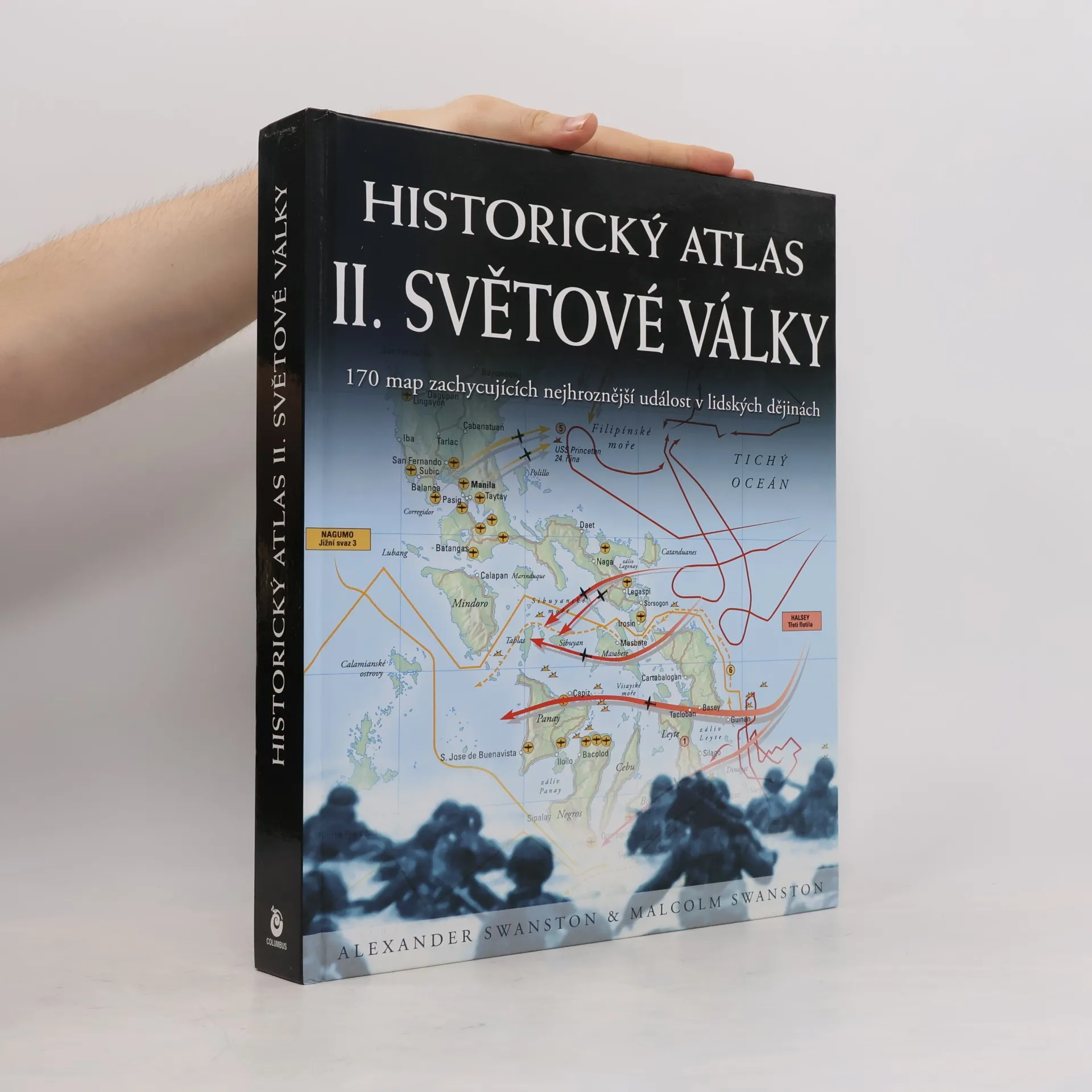
Historický atlas II. světové války
- 399bladzijden
- 14 uur lezen
Od německého přepadení svých sousedů až k shození atomových bomb na Hirošimu a Nagasaki poskytují barevné, počítačem vytvořené mapy s doprovodným textem srozumitelný rozbor tohoto období lidských dějin. Historiký atlas II.světové války poskytuje detailní pohled na všechny důležité události a bitvy, ke kterým došlo v letech 1939-1945, počínaje přepadením Polska nacistickým Německem dne 1. září 1939, které vedlo k vyhlášení války Německu Británií a Francií a konče závěrem války, kdy byly definitivně poraženy německé a japonské síly. Je zachycen i německý ústup až ke konečné kapitulaci dne 8. května 1945 a boje pokračující v Tichém oceánu. Konečným rozhodnutím, které ukončilo šest let trvající strašný konflikt, který děsil celý svět, se tak stalo svržení atomových bomb na japonská města Hirošimu a Nagasaki v srpnu 1945. Výtečné původní mapy doprovázené podrobným vysvětlujícím textem ukazují všechny důležité bitvy a události druhé světové války. Byly pečlivě připraveny a vytvořeny na počítači, aby zachycovaly maximální detaily a poskytly vhled do strategie sil Spojenců v průběhu války. Kniha se zabývá všemi klíčovými událostmi šestiletého konfliktu důkladně zpracovaným textem doprovázeným podrobnými mapami, které poskytují naprosto originální pohled na tuto celosvětovou válku.
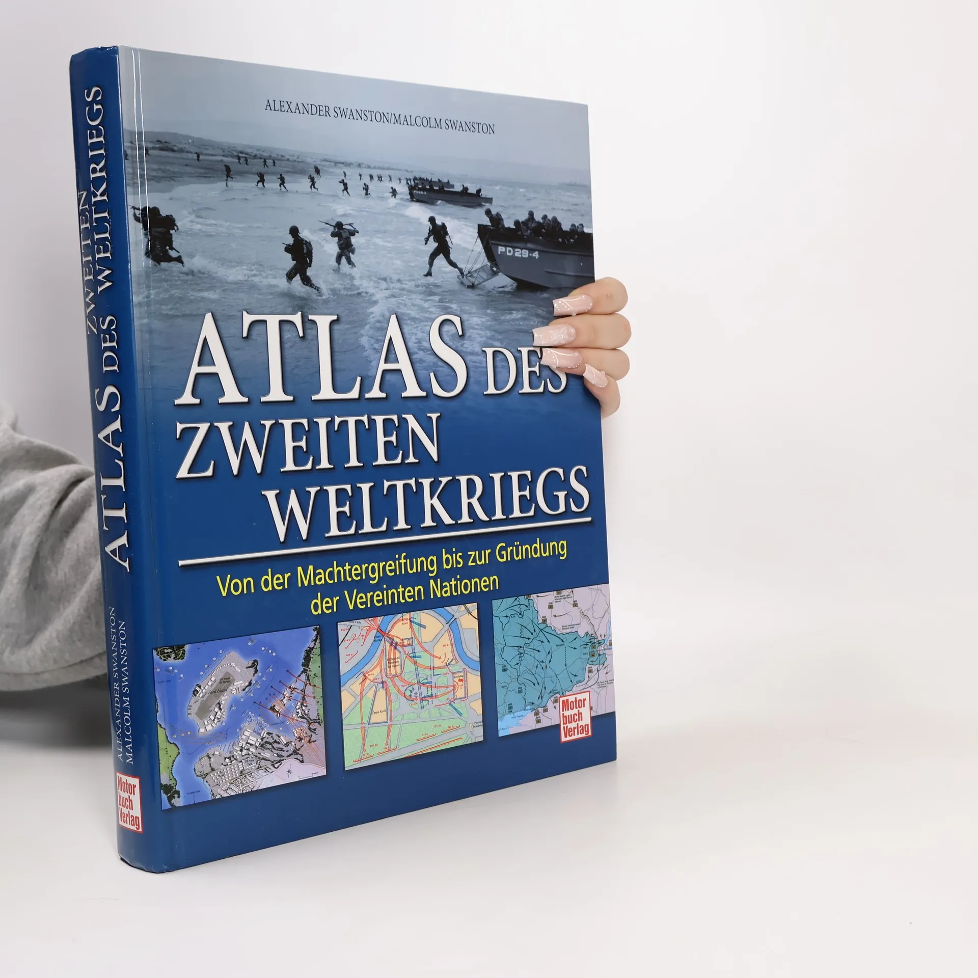
Atlas des Zweiten Weltkriegs
Von der Machtergreifung bis zur Gründung der Vereinten Nationen
- 400bladzijden
- 14 uur lezen
Bücher über den 2. Weltkrieg gibt es viele, dieser Band aber ist besonders - durch seine rund 170 Karten von den wichtigsten Kriegsschauplätzen rund um den Globus: Aufmarschpläne, Kampfverläufe, Abschnittskarten mit Zuordnung der beteiligten Truppenteile bis hin zu Stadtplänen. Eindrucksvoll sind auch die historischen Fotos vom Kampfgeschehen, die Informationen über die Hintergründe des Krieges, den Verlauf an West- und Ostfront sowie die Kämpfe im Atlantik und Pazifik. Der Luftkrieg, der Seekrieg und die Nebenschauplätze wurden ebenfalls nicht vergessen. Ein umfangreicher Anhang mit Statistiken rundet die Darstellung ab.
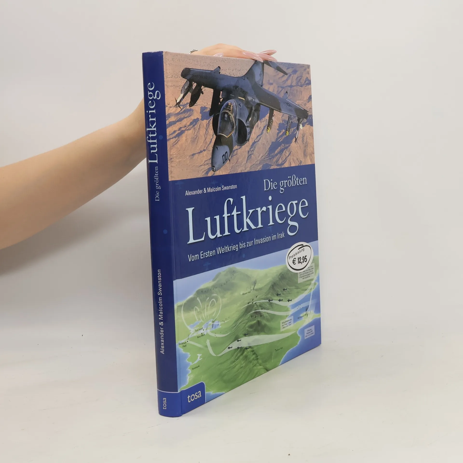
Die größten Luftkriege
- 224bladzijden
- 8 uur lezen
Das Schießpulver mag die Schlachten verändert haben, doch das Flugzeug veränderte den Krieg selbst. Bald nach den ersten erfolgreichen Flügen zu Beginn des 20. Jahrhunderts erkannten Visionäre das revolutionäre Potenzial des Flugzeugs in Bezug auf die Kriegsführung. Hier erfahren Sie, wie das Flugzeug in erstaunlich kurzer Zeit in der Lage war, militärische Konflikte zu beherrschen – und bis zu einem gewissen Grad auch unser aller Leben.