
Parameters
- 200bladzijden
- 7 uur lezen
Meer over het boek
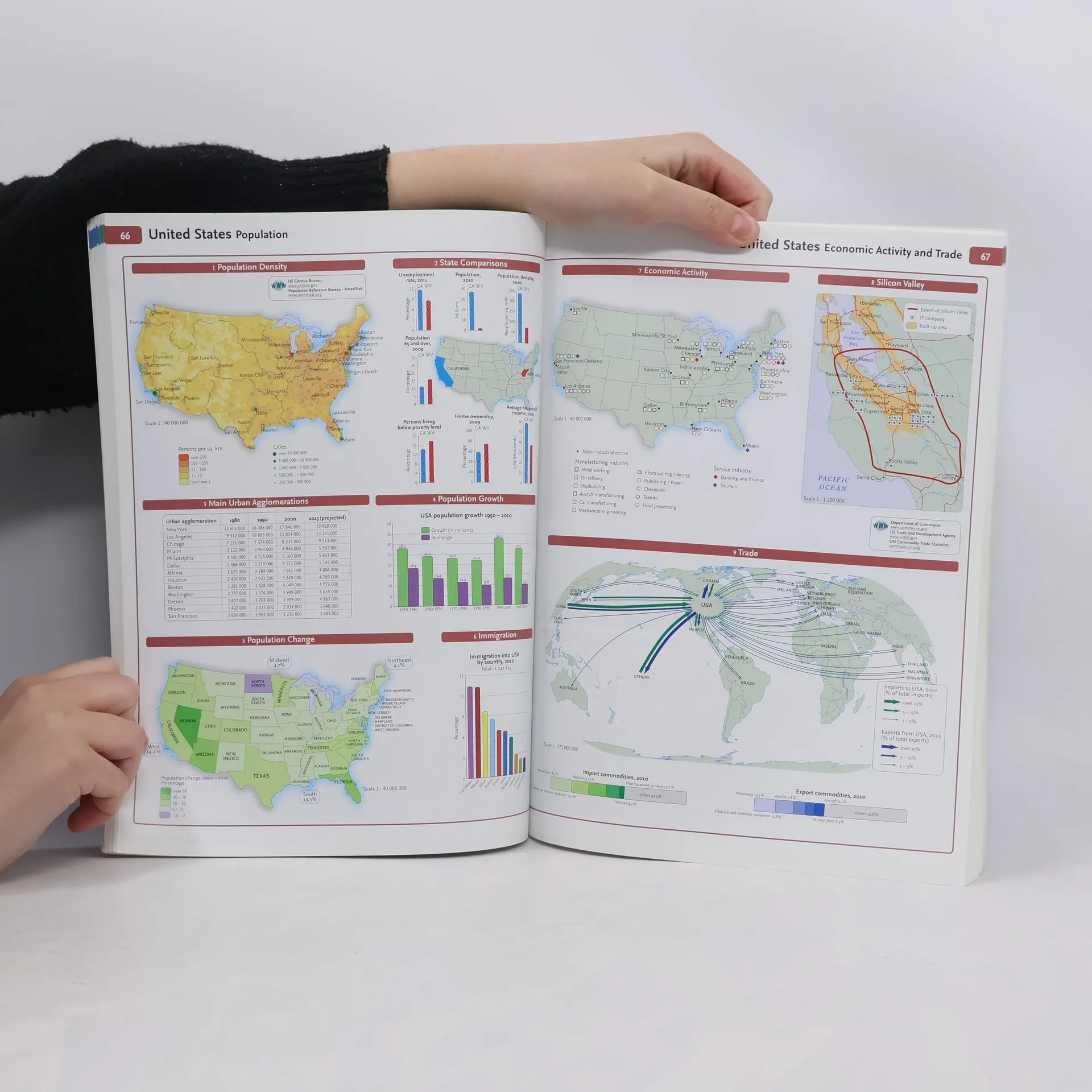
A new and extended edition of a vital tool for students, with new topics including world agriculture, world climate change, low and middle economic developing countries, and ecological footprint Although specifically designed for students aged 14-16 years, the well-researched uncluttered design of this reference makes it suitable for all students. This edition has been extensively revised, updated, and extended with up-to-date reference and thematic mapping, mapping skills, country-by-country statistics, and a fully comprehensive index to all names appearing on reference maps. All maps have been fully updated using the latest statistical information available, while the inclusion of a selective list of web addresses on each thematic page ensures students are motivated to explore more deeply into a topic. High quality satellite imagery, selectively used within special topic or study areas, supports data on the maps and is used to illustrate key environmental issues. Extensive lists of statistics for demographic and socioeconomic facts provide up-to-date data for students wishing to create their own graphs to support individual geography, tourism, mathematics, economics, or IT projects.
Een boek kopen
Collins Student World Atlas,
- Taal

- Jaar van publicatie
- 2012
- product-detail.submit-box.info.binding
- (Paperback)
Betaalmethoden
We missen je recensie hier.
- Titel
- Collins Student World Atlas
- Taal
- Engels
- Auteurs
- Uitgever
- HarperCollins UK
- Jaar van publicatie
- 2012
- Formaat
- Paperback
- Aantal pagina's
- 200
- ISBN10
- 0007437811
- ISBN13
- 9780007437818
- Reeks
- Tags
- Non-fictie, Kaarten en reizen, Geografie & Plaatsbeschrijving, Handleidingen en Gidsen, Voor kinderen en jongeren, Atlassen
- Beoordeling
- 4,45 van 5
- Aantekening
- A new and extended edition of a vital tool for students, with new topics including world agriculture, world climate change, low and middle economic developing countries, and ecological footprint Although specifically designed for students aged 14-16 years, the well-researched uncluttered design of this reference makes it suitable for all students. This edition has been extensively revised, updated, and extended with up-to-date reference and thematic mapping, mapping skills, country-by-country statistics, and a fully comprehensive index to all names appearing on reference maps. All maps have been fully updated using the latest statistical information available, while the inclusion of a selective list of web addresses on each thematic page ensures students are motivated to explore more deeply into a topic. High quality satellite imagery, selectively used within special topic or study areas, supports data on the maps and is used to illustrate key environmental issues. Extensive lists of statistics for demographic and socioeconomic facts provide up-to-date data for students wishing to create their own graphs to support individual geography, tourism, mathematics, economics, or IT projects.